9 peaks
This trip started out as an unknown for me. It would take us into some country that I’d never even thought of going. I’d heard of this Strathcona Park place before but had never really seen any of it aside from the lodge perched on the side of Buttle lake.

Erik thought we should get out there and check it out. How tough could it be? Looking at reviews online. Steep….steep…..steep…. lots of flowers. Oh I like the flower part, what did it say before that? Apparently it’s steep. The reviews weren’t joking around.
We arrived at the trailhead as it was getting dark and decided to hike until we found a suitable tent location and continue on in the morning. Do you know how hard it is to find a camping spot on the side of a ridge when it’s pitch black out? We went about 3 km in that night and were able to find a nice flat(ish) spot next to a stream.
I woke up the next morning partially on the ground. I hadn’t closed one of the valves on my sleeping mat the whole way and they don’t hold air well when they are open. Grab the food caches, down a quick breakfast and continue on up the incredibly steep hill. It wasn’t all fun and games going straight up the hill, there was the odd flat section and then we’d round a corner to find more steep hill. Did I mention it was steep?
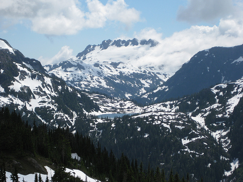
After what seemed like ages in the trees we started to see more sunlight and then burst out of the trees. Almost accidentally we stopped and turned around to take in the incredible view down the valley of the lake kept in place by high green ridges.
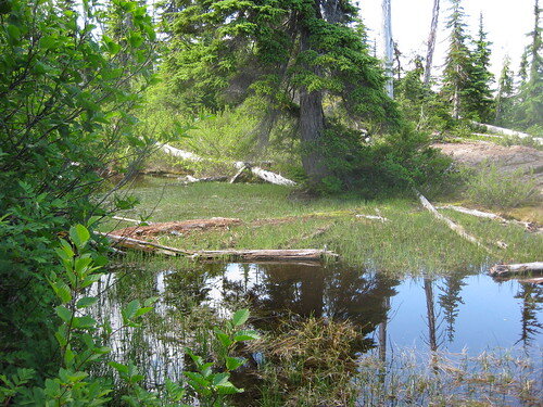
For those not wanting to go to far down the ridge or needing a spot to camp soon after coming out of the trees there were a few here. There were a few ponds but not much nice water.
There is a pretty good trail down the ridge from the end but we decided to meander a bit and take in the scenery. It’s hard to get lost up there. You can see the other end where you want to go and you can’t really go off course too much; walking down-hill equals off course.
We weren’t sure exactly where the “South End” of the ridge was but stopped where we thought was almost the end in a fairly protected rock outcropping. We ended up being about a kilometre away from the end of the ridge but there was much more snow further on so we decided to camp out here. It provided some incredible scenery. The picture at the top of the post was taken 30 feet away from the tent.
The following day offered little in the way of surprises, only beautiful scenery and decent weather. We meandered our way back down the ridge and descended into the woods. The way down was nicer on the quads but not so much on the rear end. The loose rock is frickin slippery!Going up on the way out and down on the way back is definitely the way to do it!
Gear for Flower Ridge
Shoes: Salomon Wings
GPS: Garmin Colorado 300
Backpack: Arcteryx Naos 50 – This bag was a delight to use but didn’t really have a chance to shine. It stayed relatively dry the entire trip so the waterproof exterior of the Naos didn’t really come into play. If there is one midsize bag to get for the wet west coast, this is it.
Tent: MSR Hubba Hubba – always a pleasure carrying.
Stove: MSR Windpro – nice in the wind but a little slow with the cooking.
Water Purifying: Steripen – First time we used this one. Probably wasn’t required with the water coming straight out of the snow but we could sleep easy knowing there (probably) weren’t any bugs going to ruin the trip(or our next week). It’s extremely light and a pleasure to carry. Read the manual once to get the gist but it’s pretty straight forward. It’s a little finicky when the battery is cold.
GPS for Flower Ridge
The trail is very clear on the way up to the ridge and then it’s walking along the ridge. If you want to continue on down the other side or around one of the other ridges, a GPS would be handy.
Extra Links
Track on Trailpeak: http://trailpeak.com/trail-Flower-Ridge-Trail-near-Campbell-River-BC-1221
Images on Flickr: http://www.flickr.com/photos/rcthink/sets/72157616691076118/