This post is from Chris Presslauer, a friend of mine I’ve known for a while. He recently returned to Vancouver Island after spending some time in Finland and had to get out to some local Island mountains.
***
This trip report is for Mt. 5040 which I hiked back on July 5th. This hike has easily been my favourite of the summer and I strongly recommend it as a medium difficulty day-hike with some spectacular views.
We headed out on July 5th at 7am from Nanaimo to conquer the 5040 peak. The summit had previously eluded us when we called off a day-hike in white-out like conditions the previous week. Now with clear skies we were determined to reach the top. To find the trailhead we used the guide on SummitPost and headed for the Cobalt-lake trailhead. After a quick stop at Tim Hortons we made our way to the Marion main line.
As it mentioned on SummitPost, this logging road was not labelled with any signs, but it was very easy to see as we approached it. Once on the road, we locked in the 4×4 and started heading up. Initially the road was in pretty good condition. Following our guide, we made our way to the bridge where the Northwest route starts. However, we chose to do the Cobalt lake route and continued along the road. This trail is shorter as you start at 600m elevation compared to 400m. From here the road began to deteriorate rather quickly with lots of large, deep, washouts. On this particular trip we were in a big F250 4×4 with plenty of clearance. But the previous week we had been able to reach the Cobalt lake trailhead with an AWD Subaru Outback. Although we did scrape it up a bit on the way back down.
After measuring the 3.5km from the bridge we arrived at the trailhead at about 8:30am. Finding trailhead was a bit tricky as it was just a piece of flagging tape next to the road about 5m back from the pullout where we parked the truck. After gearing up, we headed into the logging slash for the first part of the trail at about 8:45 am. This part was actually very easy. The trail is well carved into the slash with lots of flagging and not much elevation gain. Overall it was a nice walk to start off the hike. After about 15 minutes in the slash we reached the forest where the trail got very steep. The hike up through the forest lasted about 45 minutes, including a brief stop on a small rock bluff halfway up. While this is probably the most physically demanding part of the trail it was still very well-marked with no branching to get confused with. At the top, after a final scramble up a rock bluff, we reached the sub-alpine where the snow began (~900m).
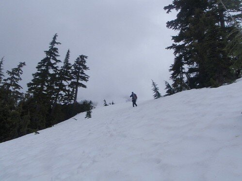
Once in the sub-alpine the trail disappeared under the snow and the flagging became much sparser. However, the route is still easy to find as we just headed north along a ridge that follows the creek draining from Cobalt Lake. This stretch lasted about half an hour with us reaching Cobalt Lake at about 10:30am.

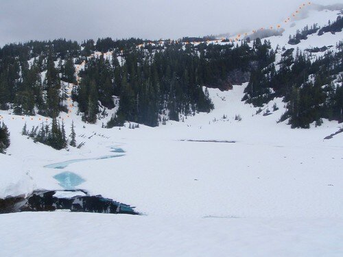
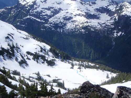
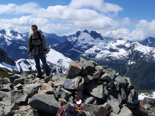
At Cobalt Lake we took a break for some sandwhiches and planned out our route to the top. Once we were ready to go, we crossed the creek and headed west along the shore of the lake and up a steep hill to another ridge. From there, we headed north along the ridge before the final steep hill to the summit. On Summitpost, it mentioned two possible approaches to the last hill. Either directly up (very steep), or a traverse east and around the summit and coming up on the other side. We took the direct approach and were able to do it with ice axes but no crampons. On the way down we took the longer route and it was much easier but a bit longer. It was just under an hour and a half from the lake to the summit (~1550m) and we arrived around 12:30pm. At the top, we took in the spectacular views, ate some lunch, and signed the guestbook before sliding down the snow on our way back.


While the amazing views are the main attraction for this hike, I wanted to point out a few other benefits of this place. For one, it would be very hard to get lost. The flagging and trail up to the sub-alpine are very good. Through the sub-alpine up to the lake you just follow the creek. And anywhere above the lake you will always be able to maintain a visual of the lake which would allow you to get your bearings even without a compass or GPS. There was also no exposure to cliffs which is nice if you are not very comfortable with heights like I am. And finally the hike has a moderate level of difficulty that I am sure the average hiker would be able to do. I hope this is of use to anyone considering the hike.

Thanks for sharing