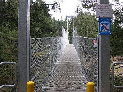
The Top Bridge mountain biking trails around Parksville are excellent single tracks to start the year out on. These trails are located right behind the truck weigh scales near the south end of Parksville. The road turns into a good gravel road pretty quick and then descends a gentle slope past a gun range. Continue to the end of the road where you’ll see a pedestrian bridge and can go no further. You can ride over the bridge and try some of the trails on the other side or take a quick jaunt back up the road to the yellow gate (on the right if you are heading towards the bridge).
We started the ride off going past the yellow gate and up the road to the trails in that area. The first thing we ran across was a small dual slalom course. This course starts up the road a ways and then ends down near where we parked.

All the trails by the yellow gate are fairly tame and don’t require a lot of technical experience. There are a few features that can be ridden by the more experienced to make the trail very enjoyable.
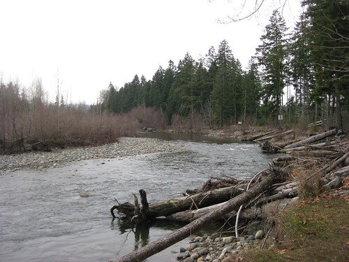
Heading across the metal pedestrian bridge on the bikes we hit a whole other area with more trails. We took a left after the bridge and continued on this trail that parallelled the river. There were a few sections on this trail that were quite difficult. It was very ridable in the downstream direction but much more work going the other way.

The favorite trail that day was Gay Bar. It was in the area by the yellow gate and was much longer than all the other trails in that section. There wasn’t a lot of downhill but not a lot of uphill either. It was a bit strange to see the person riding in front of you ride by and then finally end up in that spot 5 minutes later. One look at the map will show you all the switchbacks in the trail. The downside is the trail seems to go nowhere but the upside the trail goes on for a long time in every little space.
Try out these trails when you have a chance. They offer a great ride if you are looking for some fun single track to play around on but also expand in a huge array of trails for longer rides!
The trails seem to go forever to the left across the bridge. It meets up with a logging/forrest access road that I think goes all the way up to englishman river falls.I was riding around the area the other day, ended up at a sign that said I was 7km away from getting to englishman river falls park, after that I went down some trail to the right on that side of the bridge and ended up at the end of Martindale Rd.
Cool! Was there where you wanted to end up?
Not really. I didn’t have an exact destination that day, the plan was to check out the trails on the other side of the bridge a little more. Mission accomplished! It wasn’t a bad place to end up, that’s like a 5 minute ride from home. I also decided to detour down wain rd to see if there was a trail at the end that could take me back to the island highway, sure enough there was one that took me through camp douglas (an old scout camp) and spat me out at the end of Parry’s Park rd.Next time I go out I think I am going to try to ride from my place in san pareil all the way to englishman river falls park. Something like this: http://goo.gl/maps/pOHu (hopefully that link works) I don’t know if I’ll make it the entire way, know of any trails from the falls that go down the river and meet with one of the lower roads there? Road riding is tiresome on a mountain bike 🙂