With the switch to phones for everything these days, it’s no wonder everyone is using them for GPS as well.
I’ve used some of the best dedicated trail GPS out there and, while there are some pros and cons, phones are just the easiest GPS to use on the trail. They take photos, connect to the internet, upload tracks and images.
One thing to remember with any phone app is battery life. Using the GPS is very taxing on a battery and you’ll run out of juice much faster than normal. If you are using a phone for your GPS then you better have a battery pack with you to charge or you’ll run into trouble.
(We’ve also got reviews up here on Outdooractive and OnX GPS apps.
Finding Trails
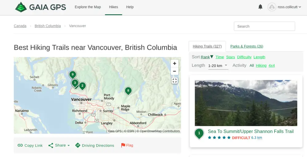
Finding trails is easy on Gaia GPS. On the website there’s a Hikes page that detects where you are and suggests some hikes. You can just search an area too.

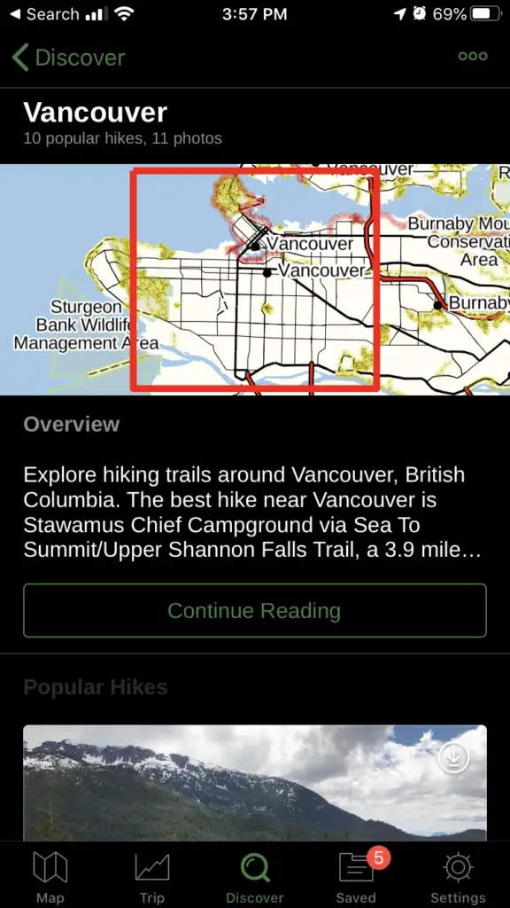
On your phone in the app, there’s a Discover button bottom centre of the app. It will detect your location or you can put in other locations


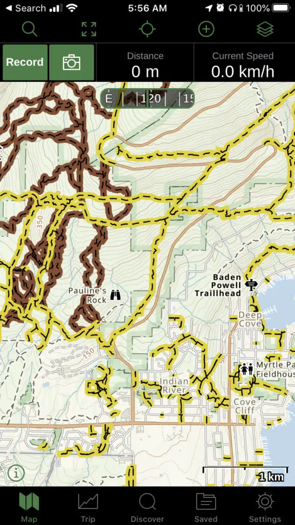
Another way to find trails is to use the map. On mobile or desktop, you can just scroll around in the map for any area. Any trail you are interested in, you can click on on the map.
Recording a Trip
Once you’ve found your hike or want to add a new one that’s not on the maps, you can record a track.
On the map in the mobile app, hit the Record button. That’s it. The app will track where you go on the map and display it there. It can help you get back to your car or just create a GPS track to look at later.
While you’re recording, you can take a photo in the app which adds it to the track as well. This helps you tell the story of your hike or others see what the hike was like.
When you are done hiking hit the record button again and choose finish. Here you can enter a new name for the track. You can also add any other photos taken during your hike to the track if they weren’t taken in Gaia.
Organizing Tracks
The best part of Gaia GPS is that it’s so good at organizing tracks. Within the app you can make folders with tracks and photos in it. You can take these folders and put them in other folders.
For example, I’ve got this folder called Waterfalls. Within the Waterfalls folder is a bunch of other folders for specific water falls. Each waterfall folder has a hiking track in it and sometimes a driving track and photos.
My favourite part of Gaia is being able to see all the items within a folder. If I view my Waterfalls folder then I’ll see every track in all the sub-folders. If I just want to see one waterfall then I can click on that folder.
Sharing Tracks
Sharing tracks and folders is easy from Gaia. In the mobile app there’s a little Sharing icon you can click. there you can set the privacy on the track and get the sharing link. You can keep tracks private if you don’t want to share them or you want to wait to share them.
If you want to share from the desktop go to a folder or track page and click the share buttons in the top right.
Free vs Membership vs Premium
Gaia GPS has a very good free app and there’s options to go to a Membership or Premium levels too.
The biggest difference between Free and Membership is the offline mode. When you’re going out of cell reception, you can download the maps and still see them on your trip. Make sure you do this before you go!
You can also print maps from the Membership type of account as well. Membership subscriptions are currently $17 USD (usually $20) per year or $60 for 5 years. If you buy your membership through the website and you get a discount.
Premium subscriptions are a step up from Membership for $36 (usually $40) per year or $160 for 5 years.
Premium gets you the full catalog of maps including NatGeo Trails Illustrated. Backroad Mapbooks Canada, US hunting maps and more. This subscription works great if need one of the specific maps. I love the Backroad Mapbooks Canada map and use it a lot for finding trails. For hunters, the land use and hunting maps make planning trips much easier.
How to offline maps
If you have a Membership or Premium subscription you can take maps offline.
To do this on your phone tap the plus button at the top of the map, click Download Maps, then drag the red area over the maps you want to save. Use the slider in the top left to change how much you’d like to zoom in when offline. The more you can zoom the more space the maps take up.
To see what you already have saved offline, click Saved, click Filter in the top left, select Maps. Here it will show you the area you have saved. I try to name my map downloads so you can remember what area it’s for.
Alternatives
There are some alternatives to Gaia in the GPS app space as well. AllTrails and ViewRanger come recommended as well. I haven’t used these apps in a while so I will update this section as I use them more.
Verdict: Highly Recommended
If you’re looking for a great iPhone or Android app to track hikes and organize tracks and folders after, definitely look at GaiaGPS. The track embedding and sharing is a huge bonus as well.
I like the app. I bought the basic membership and tried to download maps. When I try to download it sends me to buy the membership. When I click it tells me I already have it. So I have an app and membership that it wont let me use and there is no support available for non-members, so I can’t figure out how to get thru the glitch.
Great navigation tool… but missing several VERY BASIC yet important features – like the ability to change line thickness and the order of visibility of layers.
Their folders also have the incredibly frustrating bug (“feature”, they will tell you) of auto-zooming when you enter a new folder… meaning I spend half my time zooming back in to my area of interest on a map.
Users have been asking for these deficiencies to be fixed for years, but GaiaGPS either doesn’t respond at all… or gives some platitude like “aww… cute idea… but we don’t have time to work on it.”
Good times dealing with bugs and ‘features’. I realize they can only do so many features but understand the frustration. I’m a computer programmer too and it’s hard to get them all in. I haven’t checked but do they have an idea voting section of their site?
I have been a Gaia GPS user since the app was first launched (using it for wildland fire fighting) and continue to use it to this day (for hiking and boondocking). While the app has utility, each update and upgrade has made it more diffiocult to use and buggy. Downloading maps has always been a major downfall and is even worse now – often requiring multiple restarts of the app over extended periods of time. The status bar in recent versions takes up 1/8 of the screen. The original version took up less than half of that. The map list on the web map has never been sorted and still contains maps that are no longer available. The app cannot search for DMS coordinates -only decimals. Bottom line: if you are a hard core, outdoor map user it may be worth investing money in but you will also be increasingly investing time getting the app to function like it used to and like it should. Also, they just increased the pro price despite the app working less well compared with previous versions. TrailBehind (developer)! If you’re reading this: stop monkeying with the app, fix its faults and also bring back the old online user discussion space!